ImiSightTM

Multi Source Intelligence System & Service

Go To App

ImiSight Intelligence System

ImiSight system and services utilizes years of developing state of the art technologies for multi sensors visual data reception and processing, advanced GIS solutions, high end intuitive & user friendly interface along with professional image exploitation knowhow towards a complete end to end intelligence system and services.


The multi sensor multi task system processes vast imagery data and provides immediate access to integrated coherence situation awareness by providing smart solutions to its customers' needs.

ImiSight can integrate with any ISR sensors, customers' or third party legacy and new sensors.


With either SaaS or stationary services ImiSight is the ultimate solution to a wide range of diverse industries needs.


Views & Reports are designed, produced and published on demand in a variety of formats

V
From data collection through advanced image exploitation processes to meaningful information
V
Relevant for real time and off line research missions
V
Automatic processes, fast Big Data management and analytics
V
Multi Sensor – multi source data reception in various formats
V
Scalable system that meets customers’ needs
V
Cloud based & stationary, configurable Services & Solutions
V
Adaptable to both market standards and customer designed protocols

Solution & Services Architecture

Powerline monitoring

Input Data

Integrates data from multiple sensors as well as customers’ existing data base

Storage & Database

Store the data and enables processing

Algorithm Cloud

Algorithm & 3D servers for automated / semi-automated analysis

Views & Reports

Configurable & on demand

Process

Planning

Advanced mission planning tools that reveals complete status overview provided by the collection assets, highlighting extracted areas of interest and plans additional collection tasks.

Collection

Including remote sensing & GIS capabilities to retrieve and display all data as part of the monitoring & intelligence workflow.

Analysis

ImiSight receives, processes, exploits, generates & archives various stills and video imagery data in variety of formats. The system incorporates additional data layers such as roads, urban areas, land use thematic maps and more…

Task Scheduler

For both real time, future & repeating monitoring tasks as well as in depth off line analysis.

Dissemination

ImiSight generates views & reports tailoredto customers' needs, including alphanumeric reports, annotated video clips, 3D models and GIS data layers. On demand, modular and as a routine task.

Image Exploitation

ImiSight improves the intelligence production cycle by factor, using automated / semi-automated image exploitation capabilities:
• &nbspImage enhancements tools - Image improvements, noise reduction and more to support object recognition
•&nbsp Geo location and spatial orientation tools
•&nbsp Advanced photogrammetric tools as mosaic
generation, stereo view
• &nbspChange / Motion detections tools – flicker, blend, video tracking and more
•&nbsp 3D view with fly-through capabilities
chart

Solutions & Services

ImiSight fulfills various cost reduction, yield increasing and
intelligence monitoring solutions to many industries, such as:

Rural Area
Precision agriculture, Precision forestry, Mineral exploration, Oil & mining, Environmental support & government compliance, Natural disaster management
Urban Area
Urban planning, Real estate monitoring, Change Detection, Cellular networks, infrastructure protection, Population behavior monitoring
Corridor Mapping
Transportation planning and protection, Powerline monitoring, Oil & Gas pipeline planning and monitoring
Additional
Not limited to specific industry ImiSight can monitor, plan, manage and improve operational management of any spatial or motion related industry

Imisight Analysis Examples

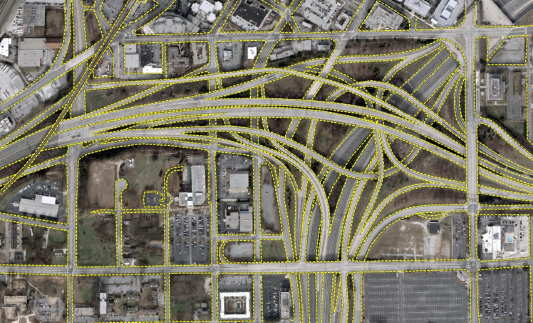
Intersection roads mapping:
Automated feature extraction from RGB images
forestry
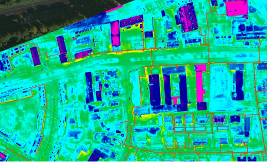
Heated water monitoring:
Underground pipeline classification from thermal IR images
Heated water monitoring
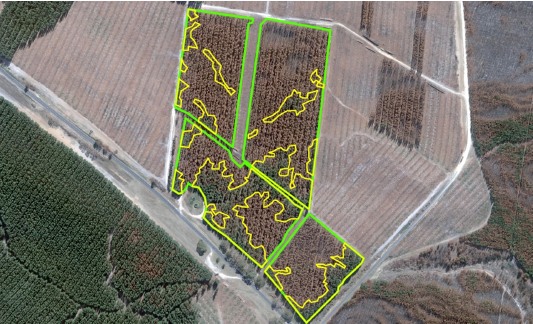
Forestry:
Live tree area inside a burnt plantation
Intersection under construction
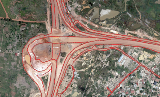
Intersection under construction:
Digital height model and RGB image analysis
Intersection roads mapping
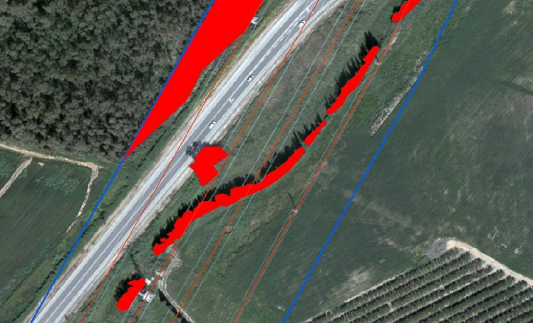
Powerline monitoring:
Potentialy disruptive vegetation detection
Powerline monitoring

Contact Us